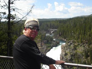
NA Motorcycle Ride - 2006

This blog is to document a motorcycle trip through western North America in 2006. Tentative schedule is to leave Houston, Texas on June 28, 2006, traveling first to the Grand Canyon, then through Utah to Glacier National Park, to Banff, Calgary, and then on the Alaskan Highway to Anchorage; return routing using the Alaskan Ferry system to Prince Rupert, B.C., returning down the Pacific coast, through Shasta NF.

My Photo
Name:
Location: Beverly Hills, FL, United States

Saturday, July 29, 2006

July 29, 2006 Day 19 – 486 Miles Beaver Creek, YT, Can – Fairbanks, USA

Beaver Creek, YT, Can – Fairbanks, USA

Worn out from my strenuous ride of yesterday, my plan appeared to be working as I slept the sleep of the dead from 10:00 p.m. all the way up to 6:00 am. Missed the rooster, but woke up a couple of hens. I did take what had to be one of the world’s greatest showers. Perhaps it was the fact that I had to pay an additional $3 Canadian for it that did it, but, man, was that a shower. Hit the road unsuccessfully trying to figure out cross-border U.S. and Canadian relations.

Whenever you pull out of Beaver Creek you almost immediately come upon the Canadian customs checkpoint. Going toward the U.S. I wasn’t required to stop here; I would have to stop at the U.S. customs checkpoint, which was ONLY thirty (30) kilometers down the road. The purpose of the “buffer” zone? Beats the hell outta me, but I do know it’s illegal for anyone, Canadian or American, to hunt in there. (Probably reserved for the Dept. of the Interior’s big brass from both governments).

The road remained hazardous due to the frost-upheavals and loose gravel spots, but this doesn’t deter ones consciousness from realizing that the land just looks prettier on the U.S. side up here. This section abuts the Tetlin National Wildlife Refuge and is a very pretty ride.
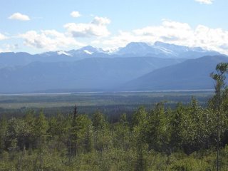


Tetlin National Wildlife Refuge


The dangers of the road aren’t far away though. I stopped in Tok to catch up on laundry, knowing I’d be staying at a decent motel in Fairbanks tonight, and met a young guy on one of those all-engine Hondas, I think they call it a Valkyrie. In any event, his father and mother lost their Valkyrie after hitting a major pothole just east of Tok at about 40 mph. They were pulling a trailer and, when it hit the pothole and jumped up in the air, it took the backend of the bike off the ground with it, evidently pulling it to the side and out of "track." They were banged up a little but safe. The young fellow said he was changing his mind about helmets (He was wearing leather with all sorts of anti-helmet law stuff on it). His father's helmet was scratched, but he said large chunks of his mother's helmet were missing. He told me the first words out of her mouth when she sat up was, "I love this helmet." I went through the area twenty-four hours later and it was rough, but easily manageable, especially at 40 mph. I think this is an example of an unreported potential hazard with pulling one of those little buggers.
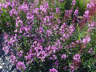


Not all the beauty here is in big, majestic scale scenes.
These flowers grow much like Texas Blubonnets, covering high meadows fields with color.
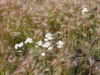


My favorite picture to date. The small flower-like plants surrounding the white blooms are very interesting. They look more like a "flowering" grass than a plant.


Got the laundry caught up and headed to Fairbanks. The official end of the Alaskan Highway is Delta Junction, about 95 miles south of Fairbanks. This is because there was already a road between Fairbanks and Valdez, which went through Delta Junction. The two towns have been arguing about this since the highway was constructed, with no official winner declared. Evidently the controversy still wages on because whenever I reached Delta Junction there was an Olympic-proportioned dust storm blown in from the north (Fairbanks). Just what I needed, high winds, low visibility, and dust everywhere. You’d have thought you were in Utah.
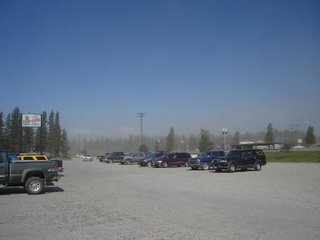


Delta Junction dust storm


Got through it okay, made Fairbanks, got a decent room (for only $116/night) with Internet connection, a bath, and went to a Salmon Bake. This is GREAT!!! With the coupon from the motel, for $26 you can eat all the baked Salmon, Bering Cod, Halibut, and prime rib you want. Showing some judgement and discretion I did not eat all I could. I could have taken another bite if I’d wanted to.

Talking with a biker from Chicago, he told me the local Harley dealer had told him today about a guy who T-boned a moose at 70+ mph. Said the moose was virtually cut in half. The rider is in critical condition with head injuries, not expected to make it.

I guarantee you, your head better be on a swivel up here. I saw many moose today, and one bear. The bear was lumbering across the road quite a way up from me (which is fine with me), but I would have like to have gotten a picture. I don't know why, I haven't taken any of the others. Even though I often have the camera around my neck, I forget all about it when I see these behemoths on the side of the road. I'm just too busy making sure we are not going to become better acquainted.

July 28, 2006 Day 18 – 518 Miles Ranceria, YT, Can - Beaver Creek, YT, Can

Ranceria, YT, Can - Beaver Creek, YT, Can

Morning dawned clear and C-O-L-D in Ranceria, Yukon Territory, Canada. As usual, I’m up and ready to go before anything is moving so I had to wait until the restaurant opened to get my coffee and breakfast. I managed to do this and set off once again toward Alaska. I’d asked one of the owners in the restaurant what the temperature was outside and he said “three-to-four.” That, of course, is Celsius. For us Fahrenheit guys, that means between 37 and 39 degrees. That’s not the important measure, though. At a speed of 60 mph the 39 degrees becomes something like 25 degrees F and that’s bloody cold; at least to this Texas boy. I rode down the road alternately putting one hand then the other between my legs trying to thaw out cold fingertips. I can report that it helped the fingertips considerably. Didn’t do much for the ambient temperature of my inner thighs though.

At Upper Liard in the Yukon Territory my Hwy 93 mysteriously became Hwy 1, but the terrain remained virtually unchanged: mountainous, winding roads, the usual number of potholes and “Caution – Loose Gravel” signs. While a pretty ride it was difficult to enjoy or pay much attention to it, I was too busy thinking about a warm cup of coffee poured generously in my lap. Didn’t happen. It did, finally, begin to warm up and I trudged onward bravely.


The Upper Laird river


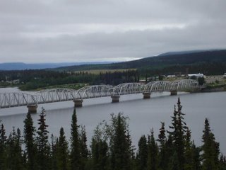
At Teslin one finds a museum dedicated to George Johnson, the first man to bring a car into the Yukon Territory. He was also a great photographer and documented many of the people of the area between 1910 and 1940. One also finds, supposedly, the longest grate-decked bridge in the world. I don’t know how long it is but my bike tried to swap ends at least three times going over. These usually don’t bother me much because I treat them as I do sand or loose gravel: maintain steady traction with the back tire and allow the front-end to find it’s own way through. That normally works on the grate-deck bridges with the bike “moving” left or right one or two “grid spans” then moving back the other way. If you let it have its head it generally moved in a narrow, though slightly scary, range. That wasn’t the case here, the front would move right, then right again, then right again, forcing me to steer lightly, more with my knees than with the handlebars. The bridge didn’t seem to like that all that much because, sure enough, a second or so later it’d begin to move me to the right again. First Republican bridge I’ve ever seen in my life.


The "Republican" bridge at Teslin


Whitehorse is the capital of the Yukon Territory and, with a population of 30,000 + exceeds the next most populous city (Dawson City) by about 28,000 folks. I never thought I’d see a traffic tie-up in a town of 30,000, but, arriving at lunchtime, I saw one here. I was part of it for awhile. In any event, I had a great Rotini dish at an Italian pasta restaurant ran by a Chinese couple (it’s Canada, folks!), and resisted the temptation to stay. I’d just lost too much road time over the previous couple of days and wanted to move…so move I did, right on through Haines Junction.

My intention was to stop in Haines Junction, but I arrived there relatively early and, leery of the cold start to this day, thought perhaps the thing to do was ride on until at least 8:00pm or so tiring myself to the point where I would sleep later in the morning; I'm tired of waiting for restaurants to open.
Out-thunk myself again; now I hit the bad road. There was a tremendous amount of construction activity beginning east of Destruction Bay (a prophetic name, or what?) following the lakeshore almost to Burwash Landing. And "following the lakeshore" is a long way. This is one huge lake. There were more than the usual patches of loose gravel; there were sections a quarter-of-a-mile long of the stuff. Lane switches between one side and the other were even more problematic; the heavy construction vehicles had dug mud holes. Riding through these was eventful to say the least. Once again, the front grew leary of what it was seeing and wanted the rear to lead. I took it steady and made it through just fine. Seriously, this wasn’t life threatening, but it made you question the status of your Last Will and Testament. Besides, the best was yet to come.

The road from Destruction Bay on into the U.S. was a serious, pay-attention-dummy road. Up here the road will heave up in the winter due to sudden bouts of cold-then-warm periods. The road department’s concept of repair is to sort of line these newly formed Whoopty-dos with loose gravel. The loose gravel is an attempt to make obscure the holes in the pavement, some of which appear capable of swallowing a small Buick. I throttled back to between 50-60 mph for the remainder of the journey and felt like I was once again riding in the Texas Enduro Circuit circa 1978-81. After about 100 miles of this I was moving that big Nomad around like it was my old 290cc Can-Am of yesteryear. Since I didn’t lay it down, it was kinda fun.

Pulled into Beaver Creek, YT, the last Canadian city before Alaska about 8:30 p.m. and got a campsite. A good meal and a few samples of Labatt's Blue later I was laying in my tent wondering when the last bears had come though this campsite. Managed to go to sleep somewhere near nightfall. Of course, that's somewhere around 2:00am this time of year.

July 27, 2006 Day 17 – 408 Miles Fort Nelson, BC, Can - Rancheria, YT, Can

Fort Nelson, BC, Can - Rancheria, YT, Can

After a great, dry night’s sleep I hit the road ready to ride, still on good ol’ Canada Hwy 97 West. About thirty miles out of Fort Nelson the rain came again. As noted, I’ve replaced the Frog Togs with a great set of raingear from Helly Hanson (funny name, great product). Worked like a charm. I stayed high and dry though it rained almost every mile until I stopped in the middle of No-Damn-Where-Canada called Rancheria. The rain slowed me down as well as quite a few animal sightings. I saw (or practically ran into) sheep, moose, bison, and one mangy mongrel dog near the campground where I stayed. It turned out to be an interesting place.

I paid for a campsite and setup, then went to gas up and check my tires and oil, anticipating getting up before their rooster and hitting the road before they opened. I wasn’t hungry but decided a few celebratory beers were in order in honor of my new, and absolutely perfect, raingear. As I walked over to the “Lodge” I noticed two Harleys. One was a Tan/Red Fat Boy in excellent shape, the other a much older, solid black, chopped Harley-something with the seat removed and stuck off to the side. Upon entering the bar I noted four guys and a girl, two of the guys obviously “belonged” here and two were obviously bikers. The girl (they almost all are girls to me anymore) was early twenties, thin, not unattractive, but not breathtakingly beautiful either. They were all talking as I came in and asked for a beer. The bikers were “running” the show conversationally, and were jovial, good companion, hardy well-met seeming sort of guys. The big one was in his late forties and, evidently, knew every dirty joke ever stated in the last forty-five years. The older, thin biker, Lance, was egging him on as proof of his claim that he (the big one) knew all the dirty jokes in the world. It turned out he may have. Some of them were damned funny.

In any event, Lance was down in the dumps because the electrical system had fried in his bike boiling the battery and burning up the solenoid and various cabling. They had called around and he and his friend were stuck there until Monday or Tuesday whenever the needed parts could be shipped to Rancheria. He was particularly incensed that this had happened given he had just completely replaced the solenoid, battery, and most of the ignition wiring two weeks earlier. My first thought when I heard this was, “Hey, Lance, buddy, wakeup, you installed it…perhaps it’s not the arrows, it’s the Indian (pun unintended).” But after several beers and hours conversation with him, I suspect he installed the stuff correctly. He just seemed totally knowledgeable on the stuff. Besides, on the back of his bike rising out of the seat was a backrest with the legend “1%” on it. I’ll let you tell him he did it.

Under the heading, I told you I didn't like bears we have the following:


'Kilt by a bear when he was only sixty-one'


There was a stuffed bear in the lodge so we took it outside and took a bunch of pictures of it in various poses with various people. I missed the high (or was it low?) point. That would be Lance mounting the bear from behind. It’s just not a pretty picture, though I had the impression he could go bear hunting with a switch.

Lance (taking picture). I was afraid to take a full-face picture. It crossed my mind it might have a duplicate in the post office.

Wednesday, July 26, 2006

Mileage Update

Mileage to date: 5,990 miles.

July 26, 2006 Day 16 – 244 Miles Fort St. John, BC, Can to Fort Nelson, BC, Can

Fort St. John, BC, Can to Fort Nelson, BC, Can

Remember me bragging that my rainsuit may have some of the magical, rain-averting qualities of my father-in-laws’ golf suit? Forget it! Not true. Not true by half.

Had a great breakfast in Fort St. John and hit the Alaskan Highway with a view to making at least 500 miles today. It wasn’t going to happen. The weather was overcast and menacing, and, about thirty minutes out, it began to sprinkle. Road conditions were bumpy in places, but overall it travels well. The rain seemed to escalate slightly with each hour, and, though it never became a full fledged downpour as we are so used to in Texas, it became very steady and soaking. Such conditions normally wouldn’t bother me in my little Frog Tog cocoon, but this was sneaky rain. It managed to find about three or four small openings in my shell and proceeded to soak me through and through. And it was COLD! By the time I reached Fort Nelson I wanted dry clothes and coffee and a break from the interminable rain.

I spied a Super 8 motel and pulled up to the entrance. A couple of the hotel staff were sitting out front smoking when I pulled up. I must have looked like a wet puppy because when I asked if she had a room one replied, “I’ll find one for you some way.” She did, and I’m warm and happy. As soon as I’d changed I went out looking for that coffee. There being no restaurant in the hotel, I asked the manager where I could get a good cup of coffee and something to eat. He replied, “Right here,” and took me back to their little breakfast section and introduced me to the coffee machine and some pizza from the place next door. May well have been the best coffee and pizza I’ve ever had. Remember me mentioning how friendly all the Canadians have been?

While I like my Frog Togs, they have a tendency to “fray” and become worn where they make contact with the seat and other clothing. I'm not sure they were designed for daily wear, and that's about what has happened on this trip so far. Additionally, the exhaust had melted a few small holes in the right pants leg. These all became the sources of my little “leaks.” I don’t know where I’m going to store them, but I just bought a set of Helly Hansen raingear with thermal linings.

No pictures today. Everyone knows what a raindrop looks like.

Tomorrow: On up the Alaskan Highway…hopefully dry.

July 25, 2006 Day 15 – 435 Miles Jasper, Alb, Can – Fort St. John, BC, Can

Jasper, Alb, Can – Fort St. John, BC, Can

Managed to sleep in spite of seeing a bear behind every bush in the campground. Woke up before anyone else in the campground, it seemed, packed up, and started the bike. That probably solved the problem of being the only one awake at the ungodly hour of 6:30 in the morning. I tried to quietly leave, but my bike only does quietly reluctantly.

I stopped mentioning my Close Encounters of the Deer Kind. They’ve become rather frequent, though only one really got my attention since that discussed going into Salmon, ID on day 11. But I’ve seen quite a few close to, or on, the road. A couple were really nice bucks in full velvet. Unhappily, I haven’t had any Close Encounters of the Dear Kind.


Saw very different country today. Left Jasper on Hwy 16 toward Edmonton, taking Hwy 40 at Hinton toward Grande Prairie. As a map will show, this route pulls you out of the high Rockies, and into high pine woods. Deep pine woods. The world’s supply of toothpicks is unthreatened as long a Canada has these resources. I can’t conceive of ever consuming all the wood available up here. This route adds a new definition to the word remote. You see nothing but pine forests and steep ups and downs for ninety (90) miles, before coming to Grande Cache. I don’t know what was cached out here, but whatever it was is likely to still be there. The connecting road to Grande Prairie wasn’t completed until about 10 years ago. It is about 115 miles. It’s a beautiful ride but the sameness of the pine forests creates some problems. I had difficulty keeping focused on driving and got very sleepy a couple of times. It can get rather monotonous.


Believe me, this place is so remote they'd welcome Genghis Khan.


Grande Prairie starts what I’m coming to call the “working man’s scenery” of the great northwest. The main roads are paved but everything else is good ol’ chunky gravel surfaces. The dust is pervasive, gagging in places where the side roads parallel the main highway. Because of this everything seems to have a gray tinge to it. I remember an F. Scott Fitzgerald short story about the coal country of West Virginia which described such an abounding “grayness” around everything. I wonder if he visited this area? Anyway, took Hwy 43 west to Dawson’s Creek.

Ninety (90) km later I’m at the beginning of the Alaskan Highway. Mile zero (0) starts in Dawson Creek. Didn’t get overly emotional about it, kept on rolling through there to Fort St. John 43 miles further down the road. Pulled in here looking to find a laundry and a decent room. I’m batting .500, got the clothes done in a very nice laundry. The hotel leaves much to be desired. I tried a couple of the chain motels and one had only one room available (with a Jacuzzi) for $275/night. I wasn’t that interested in a Jacuzzi so I passed. The others all were a little too proud of their rooms so I rode into downtown and found one which “almost” passed muster. Rate? $79 Canadian. I expected Mickey Spillane or Dashiel Hammet to be waiting in my room when I opened the door. This thing is right out of the forties-fifties. They weren't.Hopefully the bed isn’t. (It wasn't).

July 24, 2006 – Day 14 267 Miles Cochrane, Alb, Can - Jasper, Alb, Can

Cochrane, Alb, Can - Jasper, Alb, Can

Woke up early again…Surprise Me! Broke the code, though, turned over and went back to sleep. Got another hour in. Simple answers. Ol’ Occam’s Razor holds true every time

Question: When do you know you’re not starting off in the best possible mode when traveling on a motorcycle?
Answer: When you have to don the raingear before leaving the hotel.

Yep, light rain this morning in the Calgary area. Sort of anticlimactic given the hail and tornado warnings issued for the area during the night. But I was sleeping during the night. I didn’t give a ferret’s fundament.

Arose, packed up the bike, and hit the road to Banff, 95 Kilometers away. Yep, we’re on the metric system here. (I barely have the other one down.) Anyway, I figure Km times .6 yields the approximate number of miles giving me the opportunity to miscalculate distances in two systems. Who could ask for more?

My ex-father-in-law, Ken, used to have a golf rain suit with mystical properties. Whenever it rained Ken would put on his rain suit and, magically, it would stop raining and we would finish our game. I’m starting to believe my Frog Togs have some of that magic in them as well. I get a few sprinkles, but, wearing the togs, the rain, rain, goes away, one supposes, to come another…well, you get it.


Gateway into Banff area


Had breakfast in Banff. Use all the usual superlatives here. Typical, high mountain, resort area. Beautiful if you have the price of admission. Pulled out of Banff into the amazing Canadian Rockies. Let me tell you something. I love the mountains of Utah, Colorado, Wyoming. I love the good ol’ U. S. of A., but folks, our Rockies, aren’t as majestic as theirs. “Theirs” are really something. My favorite ride? No. I guess I’ll have to stick with the Going to the Sun ride in Glacier as the most spectacular…but I’ll guarantee you, this is a close second, and it’s 150 miles of it. I wish you all could be here to see this with me. I was right to make this trip. It’s reset my clock to zero.

Speaking of “them,” the Canadian folks have all been wonderful, friendly people.

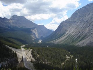
Hwy 93 between Banff and Lake Louise


Hwy 93 looking back south from one of the big "ups"


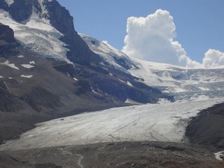
Hwy 93 at the Icefields. This is the Athabasco Glacier. Because of its location on the continental divide, water from this glacier goes to the Artic, Atlantic, and Pacific oceans


Pulled into Jasper around 3:00 p.m.. This is a little early but I don’t want to get caught out in the forest/mountains when the animals really start moving. Plus, I felt like a little down time. So…I pulled into the Whispering campground, got a site (they are really set up nice here), and am now sitting in a bar called the Dead Dog working on my third Labatt’s Blue. Why so many? Hopefully it’s bottled courage. After, Repeat AFTER, getting my campsite I was informed by my neighbor there were eight (8), count ‘em, eight (8) bears in the campground yesterday. And that was during the daytime; it appears no one was around to count them at night. Evidently the “buffalo” berries are in full bloom and the bears like them. What? Me worry? Damn right. I’ve explained the bear vs. bare issue already (see Planning). I can’t get on the internet to post this tonight so, if it’s ever posted it’ll mean I wasn’t eaten by bears and have lived through my camping experience. Not to mention riding back to the camp after three (or more?) Labatt Blues?????

Sunday, July 23, 2006

Glacier NP Pics


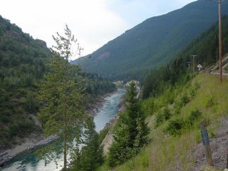
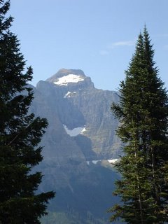
View upriver on Hwy2 "around" Glacier


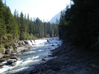
McDonald Creek just east of Apgar campground


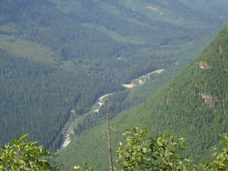
View from the Going to the Sun Road


View from the Going to the Sun Road


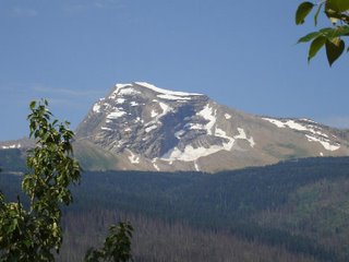
Hence the name "Glacier"

July 23, 2006 – Day 13 400 Miles Kalispell, MT – Cochrane, Alb, Can

Kalispell, MT – Cochrane, Alb, Can

I guess someone has to wake the rooster: must be my job. Up again at the hint of dawn though, today, it didn’t seem like quite so much of an annoyance since my plans were to take the Going To The Sun road actually going “toward the sun,” i.e., west-to-east. But Stupid raised his ugly head again.

When I pulled out of the motel parking lot it was too early and dark for my (prescription) sunglasses. I have a pair of shooting safety glasses with the yellow lens that is great for low light situations. Unfortunately, they don’t have my prescription in them so I see fine far away but can’t read my map (on my tank bag) very well. So...after breakfast I go scooting off toward Glacier and missed the damned entrance, staying, instead, on Hwy 2. Fat, full, dumb and happy I go traipsing “around” Glacier NP, not “in” Glacier NP. After about thirty miles it dawned on me what was happening, so I stopped for coffee to re-open my eyes and verify I was burning daylight. But it wasn’t a lost cause. The road parallels a great river with fantastic scenes. I just didn't have to stare at the sun as I (finally) rode the Going-To-The-Sun Road. I ain't mad.

Too bad I’ve used all the superlatives!! Man, do you need them for this place. Here's a surprise: I have a new favorite ride.

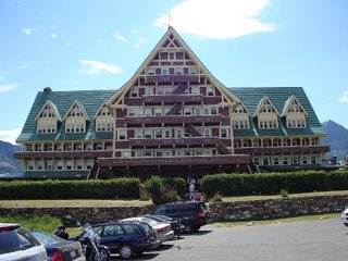
Left Glacier and entered the Waterton Lake (CAN) NP. This is a great place too. Visited the Prince of Wales Hotel, one of the last, great Canadian Railroad hotels built in 1926-27.


Prince of Wales Hotel

Cute, from the outside; small rooms, old pipes, and that "trying-too-hard-to-be-elegant" look that doesn't work so well in today's all too casual culture.


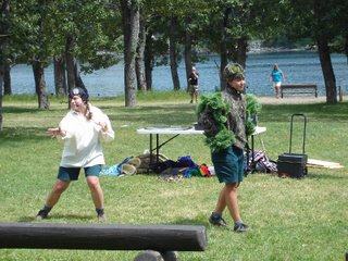
I had a late lunch down in the village and ran into a cute little "theatre-in-the-park thing being put on by two young ladies. I believe they are park service employess, and much of their message was educational, concerned with the advisability of allowing lightning-started forrest fires to burn because they helped control pine beetles which were eating up quite a few of the pines in the area. Their approach was to do some Beatles songs (naturally), and then a great take-off on Hamlet. It was pretty unique and I enjoyed it so much because they made up in guts what they lacked in talent, an attribute I throughly endorse in life. More talent than guts invariably leads to wimps or prima-donnas...give me enthusiasm and moxey every time.


Theater In The Park?


After lunch and watching the thespians I headed north on Hwy 6 to Hwy 3 intersecting with Hwy 22 at Lundbreck. Finally gave out west of Calgary and found a motel in Cochrane. Parked here for the night. Tomorrow: Banff and north again.

Saturday, July 22, 2006

Some pictures - Salmon to Kalispell


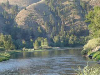
Salmon River just north of Salmon, ID


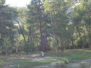
Came out for a drink (look above and slightly to the right of the dead log)

Note: Click on the picture to enlarge


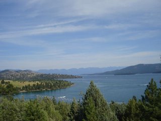
Flathead Lake, MT.
This thing is HUGE!! Hundreds of fantastic views.

July 22, 2006 – Day 12 - 276 Miles Salmon, ID to Kalispell, MT

Salmon, ID to Kalispell, MT

Up bright and early without a wakeup call or alarm clock: Christ, this aging thing brings surprises with it. Twenty years ago my heart wouldn’t start until 8:30 a.m. Now I go to bed exhausted, sleep all of six hours, and my eyes pop open like a thirteen year-old wading through a deck of porno playing cards. Had an early breakfast and hit the road for Missoula, 142 miles away, sans radio, sans horn, sans light bar lights and… discovered upon pulling into the Kawasaki dealer in Missoula, san rear brake light. Other than that, though, running hard and fast.

Wow. The ride from Salmon, ID to Missoula, MT was even prettier than yesterday’s. I’m running out of superlatives for this ride, and I haven’t even reached Alaska yet. Obviously, this is more a solution than a problem. I’ll play Teddy Kennedy on the superlatives for Alaska…cross that bridge when I get there.

Reached Missoula at 10:30, found the Kawasaki dealer and, Thank You Lord, they knew what they were doing. Lucked out even further when I discovered there was a laundry three blocks away, so I did laundry while they repaired the bike. By 2:00pm I have an electronically sound bike and clean clothes. Does it get any better than that?

The problem with the wiring? The new horn I bought had two sets of electrical connections and, when my local Kawasaki dealer installed it he just stuffed the “extra” live wires into the wiring harness evidently without insulating them. Eventually they worked close enough to arc across and short directly to ground. This burned wiring and made the horn useless. The service manager didn’t think much at all of the professionalism of the installation job and, when he asked me if I wanted to talk to the technician about what they found on the lightbar installation, I just said, "No, I expect it's just more of the same." So, because of a lousy installation by the local Kawasaki dealer I’m out $167 and about four hours of road time. Not to worry. I’ll vote with my feet.

Pulled out of Missoula about 3:00 p.m. after a late lunch and punched further north on Hwy93. Yet another nice ride. I’ll tell you, Hwy 93 may be my favorite ride ever!!! At least until tomorrow, huh?

Checked into the motel and went to a local sports bar for some grease and beer. Nice place, with nice folks in it, called FatBoys (I think). They actually had gizzards on the appitizer, though I’ll bet a bunch of you won’t agree that’s very appitizing. Tried them…liked them, though they must have come from some nuclear-warped chickens. Biggest damn gizzards I’ve ever seen. I accused one of the owners of using Emus. In any event, after that dinner my cardiologist’s wife may yet get that new Lexus.

Friday, July 21, 2006

Some pictures - Idaho


Summit just south of Stanley. First documented by Alexander Ross of the Hudson's Bay Company in September 1824


Salmon River looking upstream (rapids)


Looking downstream (smooth). Go figure.

July 21, 2006 – Day 11 - 533 Miles Provo, UT to Salmon, ID

Provo, UT to Salmon, ID

Took off with Bobby J and Zelda this morning at 7:45 am. We met up with Zelda’s son, Byron, his lovely wife, Val, and Bob’s friends Mike and Jean A from Salt Lake City. They were going to take the Jackson Hole-Teton-Yellowstone-Beartooth ride mentioned earlier. We rode together to Brigham City on I-15, stopping for a late breakfast. A nice little ride with nice people topped off with breakfast on the road: in my book, you can’t start a day better than that (without having to make a Man Law of some kind). While Bobby J and gang headed up Logan canyon, I pushed on up I-15N to I-84W at Tremonton, merging into I-86W to Twin Falls. Managed to get off interstates at Twin Falls taking Idaho Hwy 93 north to Shoshone, then Hwy 75 north to Ketchum/Sun Valley, rejoining Hwy93 just south of Challis. From there it was a straight shot north to Salmon. This is a ride.

My friend Bobby J. is like Louis L’Amour. L’Amour used to preface his books with a statement relating to his geographical accuracy. He wrote that if he says there’s a spring there, there is…and the water’s good. If Bobby J. says a ride is great you believe it, the ride is great.

The first part of the ride north from I-86 is through farmland. (You know what they grow in Idaho…if not, ask Dan Quayle.) Then there are wide valleys covered with high meadow grasses and flowers, punctuated by lava rock fissures and upheavals where volcanoes erupted millions of years ago. The contrast between the black lava rock and the green grasses and wild flowers is special. The Big Wood River parallels the road off-and-on for periods and the elevation rises smoothly until you are in high mountain pass country, peaking out at about 8700 feet at the Galena Summit north of Ketchum/Sun Valley. Then you get to Stanley and the “RIDE” really starts. The Salmon River parallels the entire journey through craggy passes, past cliffs, with the usual rising and falling grades. The country is much like the Yellowstone-Teton area but with supple differences. It’s sort of hard to explain. It doesn’t seem as high, or as “sharp” as the others, but, somehow equally beautiful. There’s a “flow” to it Yellowstone-Teton lacks. It may be as simple as this route doesn’t offer the bumper-to-bumper tourist camper, trailer, motorcycle pack traffic you see through Yellowstone. Whatever it is, there’s a peace here that is really special. And the river…you can practically see the steelhead in your mind’s eye.

My plans were to stop in Stanley for the night, but my radio lost power, a further symptom of the lousy installation job performed by my local Kawasaki dealer on both the radio and horn. Can’t live without a radio, and I really want the horn working, so I decided to push on to Salmon tonight so I have extra time in Missoula tomorrow to see if I can get someone to fix this damn shorting problem. This pushed me into late afternoon riding with all the concerns that carries. Yep, I'm talking about moving animals.

I first perked up when I saw a sign saying, “Watch for Bighorn Sheep on the Road, Next 2.5 Miles.” Now there’s a sign you won’t see in Newark or Philadelphia, isn’t it? After 5:30pm I start watching for deer moving. Sure enough, just out of Stanley with the river now on my left, I see a small yearling doe, come out of the brush toward the highway. She stops, looks at me, and I slow down looking at her. It’s a toss up which of us looked at the other the most skeptically, but I think it was me. She froze with a look on her face that convinced me she wasn’t going to jump onto the road so I sort of coasted by her probably within twenty feet. This is close enough, even with a small deer. About and hour later we tried closer, with bigger (deer).

About twenty/twenty-five miles out of Salmon, there were four of us running up the twisting/turning road north. I was in the lead leaning into each turn and swaying out with full power…the sort of thing that makes riding a bike fun. A car coming the other way blinked his lights at me just before I entered a sharp turn to the right. The guy did me a favor. I slowed and just around the turn was a big mule deer doe. She would easily field dress to probably 125 to 150 lbs. This would hurt. She was moving sort of laterally to my route looking over her shoulder at me. I slowed and we kind of ran pace for pace for 50 feet or so, her slightly in front, then she bolted straight across the road. I had anticipated this, and had slowed to the point I was able to come almost to a stop and then veer left around her as she crossed into the thickets on the right side of the road. We probably came within five or six feet of each other, closer than I liked, but I was fond of the result. There was no game crossing sign in the area, supporting my belief that deer don’t read. I’ve never seen one anywhere near those damn signs. But, still I look, just as I did for the Bighorn Sheep I didn’t see either. I suspect they don’t read either.

While we are discussing road signs, Open Letter to Idaho: Hey, dummies, your Make Idaho Beautiful, Adopt a Road signs are visual pollution spaced about every damn mile with some ludicrous never-fly-tool-and-die-like company noted on them. Put a big plaque at the start with the companies names in an almost impossible-to-read, small font and forget it. If they are truly concerned with making it beautiful they won’t mind. If it’s about cheap advertising through government, tell ‘em to get a lobbyist. That’s what they do in Washington.

End of daily bitch, and report.

Rubberside down!

Tuesday, July 18, 2006

Plans are: "On The Road Again"

Mom went through the surgery like a champ and is now recuperating.

I left central Fla. at 3:00 am cst today, arriving home in Spring, TX (965 miles) at 7:00 pm (avg 60 mph...three 30 min. breaks).

My plan is to fly to Salt Lake City Thursday morning to rejoin my bike and pick up my trip Friday morning.

Intended route is up through Twin Falls and Sun Valley, probably spending the night in or around Stanley, then on up through Salmon to Missoula on Day2. My buddy Bobby J. says this is one of the most beautiful rides he's ever been on...and he's been on most of them in the inter-mountain west. He also says one has to stay in Missoula at least one night. I'm ready to find out why and, boy, am I ready to ride again!!!!!

Interesting, Bobby J and some friends are taking the ride we took up through Jackson Hole - Teton NP - Yellowstone and adding the Beartooth ride I didn't take because of the hail storm. Sure wish I could make that ride again with them, but I have to be moving toward Alaska.

Friday, July 07, 2006

July 6 - Day 10 - 512 Miles Big Timber, MT to Provo, UT

Big Timber, MT to Provo, UT

Took Hwy291 South at Bozeman heading down to I-15 at Idaho Falls. Heading to Bobby J's house to drop my bike off and catch a plane.

This is a really great ride up through the Gallatin Valley adjacent, and partly into, Yellowstone. Obviously, couldn't enjoy it much with all that going on with my mother's health. Hope to make this ride one day with less on my mind.

The rain gear came on and off three times during the trip, the last time as I was coming into Salt Lake City. My weather luck is holding out: at the Point of the Mountain (point between the Salt Lake and Utah valleys) I got weather one can only get there. First you could see the clouds of brownish haze below and adjacent to the darkened outlines of rain falling. Yep, dust and rain. Only in Utah. And what makes this possible? Wind. I managed over about 20 miles to hit gusts that were at least 50 mph with the sand and rain stinging equally. When you're having good luck it just kinds of goes on, doesn't it.

In any event, I made it to Bob's house during the light show and spent the night. I booked a flight to Houston and arrived there this evening. Heading to Florida tomorrow.

Wednesday, July 05, 2006

Possible Premature End of Trip

Checked into the motel in Big Timber, MT to find several phone messages from my brother and sister. My 84-year-old mother had emergency ulcer surgery last night. The surgery was successful but her blood pressure is very low and she's terribly dehydrated. As of this moment the major danger sounds past, but we won't know, or feel better, until her blood pressure goes up and she is re-hydrated. I'll be heading to Salt Lake City tomorrow to leave my bike with Bob while I go to Florida. Trip may be postponed, or over. Just don't know right now.
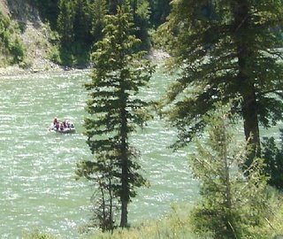
But, for what it's worth, it's been a great ride, even with the "bad" events (excluding this last one). A trip like this is just like life: it has the good, the bad, and the ugly. You enjoy the former and endure the latter two. Just as in life.

July 5, 2006 – Day 9 - 261 Miles Lovell, WY to Big Timber, MT

Lovell, WY to Big Timber, MT

It’s not 261 miles from Lovell to Big Timber, unless you take a wrong road and add about 30 extra miles to the trip. Left Lovell with the intention of taking the Chief Joseph trail (Hwy 120-296-212) from Cody, WY to Red Lodge, MT. Terry B, calls this the Bear Tooth run (I think). It’s a well-known run locally with the road rising to over 13,000 ft in the pass on Hwy 212. Didn’t get to take it, though, because I saw the, now, inevitable, rainstorms moving over the mountains. I decided to take Hwy 295 to Belfry based on a paper map that indicated a hard road all the way. Guess what, it isn’t. If you check it on Mapquest it just disa-damn-pears. This isn’t totally accurate because it turns into 16 miles of the inevitable pea-gravel. So, I turned around and went back to Powell and headed into Cody.

I’d planned on replacing tires in Helena, but, going through Cody, decided I might as well get it done. Plus, my new horn had stopped working and I wanted that checked into. Frankly, I wanted the horn fixed more, but thought I might as well get the tires taken care of at the same time. The Kawasaki dealer didn’t have the right tires, but he sent me to the local Suzuki dealer who did. They changed the tires but thought the horn problem was caused by a short in the factory-supplied wiring harness to the left handlebar turn-signal switch, and they didn’t have time to trouble-shoot it. So…got the tires (that’s good) and didn’t get the horn fixed (that’s bad).
Now, new tires have a break-in period of 50-100 miles; otherwise they can be relatively slippery. So, what do you think happened? Rain? Nah, worse that that. Hail. I saw that storm and, like most bikers, figured I could outrun it, so I didn’t don raingear as I should have (primarily because when I left the dealer the rain had started to fall and the race was on). Then the big drops turned to hail. I didn’t notice it at first, I was too busy trying to ride through a heavy and very stinging rain. At least that’s what I thought it was. I was concentrating on the blurry road through my rain-drenched glasses so hard I could only notice that this rain stung more than any I’d ever felt before. Then I glanced down at my tank bag and saw these small pieces of ice. Being the brilliant intellect I am, I immediately deduced that rain didn’t sting that badly after all. Nothing I could do about it at that point so I just hunkered down and hit the gas, praying the tires kept their grip. They did, and I outran the damn stuff…told you I could. Managed to don the appropriate raingear finally and that stopped the rain for the most part, though I caught a few sprinkles all the way into Big Timber, MT, where I said, “Enough…Uncle,” whatever, and got a room. This is allowing me to post the previously written journals plus catch up on my latest piece of bad luck.

July 4, 2006 – Day 8 - 172 Miles Lovell, WY

Lovell, WY area

Went on a great ride with brothers Wayne and Terry B, Wayne’s son, Ethan, and Bobby.

Over-exposed picture of the hole-in-the-head gang. From left to right (and I mean right), Wayne, Bob, Ethan, and Terry.


We rode out to Bighorn Lake (Reservoir), saw wild (more accurately, feral) horses and a Bighorn ewe with offspring. The road was under repair and had more than the usual allotment of pea-gravel. I wasn’t unhappy when we turned around and headed up through the Bighorn National Forest.


View from the "top" of Big Horn Mountain, before the descent to the valley on US14.

The primary road, US14Alt, is the steepest road in the U.S. with grades as steep as 11-12%. Believe me, it gets your attention. And the views…wow, the views. Stopped at the Bighorn Lodge at Burgess Junction for sandwiches and a couple of beers. (Don’t normally drink and ride, but we spaced them out and included food…seemed sufficient justification to me.)


Finished the ride by riding down the “easier” US14, stopping at a beautiful falls whose name escapes me now.


The brothers know this land like the back of their hands having grown up here and running elk hunting outfitting trips up the canyons.


We went back to Wayne’s house and had a cookout, a little beer drinking, and some more guitar music and singing. I can’t say enough about the graciousness and hospitality of this entire family. I felt at home, as if I’d known these people all my life. And I have sort of …they are like most of the real people I’ve met throughout my life. It was a pure pleasure.

July 3, 2006 – Day 7 - 270 Miles Jackson Hole, WY to Lovell, WY

Jackson Hole, WY to Lovell, WY

Left Jackson Hole about 8:00 a.m. and up Hwy89 past the Grand Teton NP and into Yellowstone NP.


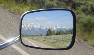
Grand Tetons - One of the most photographed scenes in America...and always beautiful.


Equally pretty in the rearview mirror.


What does one say about Yellowstone which hasn’t already been over-written about? Man, is that a special place. We toured through from the south entrance to Fishing Bridge, went to the Grand Canyon of the Yellowstone, backtracked again to Fishing Bridge then took the East Exit to Cody.


Yours truly in Yellowstone


The irrepressible Bobby J at the Grand Canyon of the Yellowstone


In Cody we went to the Buffalo Bill Museum. There was an excellent presentation based upon the lives of Plains Indians, and an out-of-sight exhibit of Remington and Russell paintings and sculptures. (Man, I hate people with talent)

Left Cody and met up with Bob’s cowboy friends in Lovell, WY. I can’t say enough about how wonderful these people are, and how they welcomed a, later, somewhat inebriated guitar player into their home and family. It was a hoot!! We played music for at least fours hours, doing, as they say...every song Hank Williams ever wrote. Plus a couple he didn’t. One of the hits of the evening was one written by Jerry O. , a friend of mine from Dallas, called, “Get off the table, Mabel, that there money’s for the beer.” Of course, that was after several cans or bottles of lubricating fluid.

July 2, 2006 – Day 6 - 320 Miles Provo, UT to Jackson Hole, WY

Provo, UT to Jackson Hole, WY


Following Bob up Logan Canyon
(PS - I know I got a dirty lense..Will try to fix it one of these days)

Great ride today. Bob and I left around 7:30 a.m. and took I-15 north to Brigham City, taking US89 up through Logan canyon to Big Bear Lake. Stayed on US89 to Jackson Hole.

Bob is called “Blonde Dog” by his Harley riding buddies and is known by practically every motorcycle rider in Utah-Colorado-Idaho-Wyoming-Montana. We’d stopped at a turnout on the Snake River when two bikers blew by at around 80 mph. A few minutes later they returned to join us. Yep, FOB (friends of Bob). We joined them for the rest of the ride into Jackson Hole, then went to a local sports bar to celebrate and have fellowship, one with another. In other words, we got pretty well smashed while watching the Ladies US Open. Fortunately our hotel was just across the street. We made it with room to spare.

Logan canyon is one of the most beautiful canyons in Utah (or anywhere else for that matter), and the ride from Alpine Junction to Jackson Hole, with the Snake River paralleling the course is fantastic. We stopped, as mentioned to view the river when Bob’s Harley buddies joined us. The river is full of rafting tourists; many complete with two-piece bathing suits. Someone suggested several “Man Laws” during this and the later “bonding” at the sports bar. But I can’t remember them right now for some reason.


Rafters on the Snake River just outside Jackson Hole.

Saturday, July 01, 2006

Day 5 - 502 Miles Grand Canyon to Provo, UT

Grand Canyon to Provo, UT

Packed up early and hit the road. Trend appears negated; no bad events today.

Took Hwy64 to Cameron, AZ, then US89 to Page, AZ. Didn’t take US89A because the north rim is closed due to forest fires. Plus, I’m a big fan of Lake Powell and have never been to Page and Wahweap marina. Now I have. If you’ve never been to Lake Powell, for God’s sake, go. It is one of the seven wonders of America. Total shoreline: >2400 miles. The canyons are spectacular, and the water is pristine. Great populations of Largemouth, Smallmouth, and Strippers. I know you think it’s a fish story but my buddy, Bobby J. and I used to smoke and fish. We have seen Striper “boils” where we had to hold the lure in our hands in order to grab a smoke. If we let it drift next to the boat a fish would hit it. Gospel friend.

Called Bobby and told him to get a bed ready, I’m coming in. Took US89 up to I-40. I was in such a hurry to get there I took I-40 over to I-15 and headed north to Provo. I know it’s interstate, but in Utah the scenery is so bloody good it almost doesn’t count as interstate. Blew into Bobby’s house about 6:30 p.m.

I’d sent Bob an email asking about riding over to Jackson Hole and, perhaps, over into Little Big Horn. Arrived to a better plan. Tomorrow Bobby forks his Harley and we head to Jackson Hole. From there we’re going into Cody, WY to spend some quality beer and music time with some real cowboy friends of his. These ain’t truckdrivers wearing cowboy boots, they actually run cattle. This is gonna be special. More later.

Plans are for Bobby to head back to Provo on Wednesday and I’ll go on to Glacier NP next, then on toward Alaska.

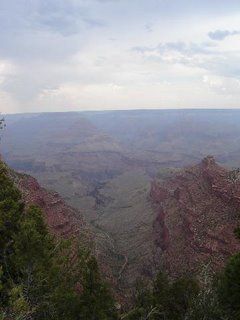
Grand Canyon Visit

She said, "Do you want me to take your picture?"
And I said, "Please."
Then I forgot to face her.


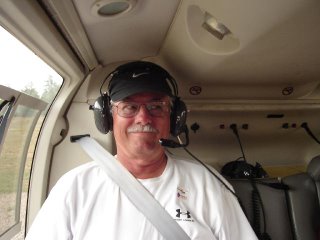
The cross-eyed author.


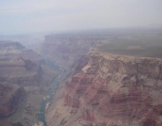
We are absolutely insignificant against this!


Overcast is due to nearby forest fires


Awesome, hanging on a rotor


Ground-level shot from near campground


Day 4 - 284 Miles Phoenix, AZ to the Grand Canyon

Phoenix, AZ to the Grand Canyon

Let’s see: Bad event day/Good event day/Bad event day/Good event day. If it can be plotted on a graph it’s a trend, right? Today? Great day.

Left Phoenix early in the a.m., heading up I-17N. Took 179N through Sedona. Man, is this a nice place! It’s one of those “artsy” communities where everything is beautiful and over-priced. I’ve noticed a high correlation between beauty and price. It applies to art, silverware, jewelry, and women; the more the beauty, the higher the cost. No, I’m not a misogynist, just an economics major.

Went around Flagstaff on I-40 and took Hwy 64 to Grand Canyon at Williams. My Phoenix buddy, Diron, highly recommended the helicopter tour, so the first thing I did was take it. You really can’t believe it. You go skimming over the pine trees 60-100 ft. off the ground and, suddenly, the bottom drops out. And from that point you realize how totally insignificant we are. After that experience, standing around snapping pictures at the various observation sites seemed totally superfluous so I opted to get a campsite and some needed ZZZZs.

The main campground was filled early so I had to go to the Desert View first-come, first-serve, campground 29 miles further down Hwy 64. Managed to get the next-to-last campsite. Had to backtrack to the main entrance the 29 miles to get something to eat. In the RAIN!!! AGAIN!! “DAMN!”

Couple of young guys (twenty-somethings) on “crotch-rockets” came in later after sites were gone. I let them park in mine, and my neighbor let them set up their tent next to his. They were from Indiana and headed toward the “coast.” That’s California to the uninitiated. One was riding a brand new bike because his blew up in Albuquerque. I guess folks were doing that kind of stuff when I was their age, but it wasn’t my “set.” We were mostly joining the service, trying to avoid joining the service, or in college getting exemptions (I guess so we could be Vice-President later on in life, huh?)

Slept good, too many hours, packed up and moved “Further on up the Road” (Love Eric Clampton’s version).

Provo, UT – Here I come.

Day 3 - 496 Miles` Bernadillio, NM to Phoenix, AZ

June 29, 2006 – Day 3 496 Miles – Bernadillio, NM to Phoenix, AZ

Yet another day like piloting a commercial airliner: hours of shear boredom followed by moments of pure panic.

Stuck on Interstates way too much. Took I-25 into Albuquerque then I-40 west to Holbrook. As fate would have it I didn’t make it to Winslow in spite of my love of the Eagles. Wanting to visit my good friends Diron and Tina J. in Phoenix I asked a guy at a truck stop which way he would recommend if he wanted the most beautiful ride to Phoenix. His recommendation was Hwy 377 to Heber, then Hwy 260 to Payson, and Hwy 87 down into Phoenix. He was right about the beauty. The road leaves desert and climbs into the Tonto National Forest. You go from sagebrush to Ponderosa Pine to Aspen. Then you go down. And I mean down. It is, I’m sure, a beautiful ride. When the weather’s good. I can't tell you, the weather wasn’t good.

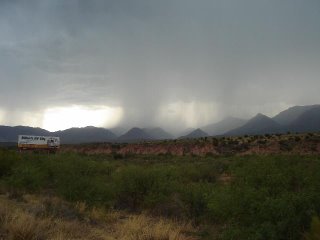
Seeing storm cells spread out throughout the mountains I stopped and suited up in my rain gear. Just in time, it turned out. Pulling into Payson the bottom fell out. I pulled into a gas station to wait it out. After it dissipated I got on Hwy 87 and began to wend my way toward Phoenix, ninety miles or so away. I was wrong...the bottom didn’t fall out in Payson. It waited until I was about 25 miles out of Payson. Then it fell out. And out. And out. Meanwhile, there is lightning striking all over the place. It looked like a light show. At least I think it did. It was difficult to see through my face shield, given how hard the rain was coming down. Pull over? No. You can’t. The road is four-laned and is switching back and forth between 6% grades down and 3%-4% grades up, and there’s nowhere for the water to go except down the road with you, or against you depending on whether you’re ascending or descending. Scary? You bet!! The only thought in my mind was: “If this bike starts hydroplaning, I’m a deadman.” It didn’t, but I don’t know why. There were places where the water rushing down at or with me was at least an inch deep. It was like riding in a shallow stream. And it was scary as hell. But I got through it. Thank you Mr. Kawasaki.

While it was raining up in the mountains it got downright chilly in that rain. But that problem was solved whenever I entered “The Valley of the Sun.” There’s a reason they call it that. The sun lives there. And he’s hot. Hotter than anything I’ve ever experienced. Let me tell you something, if you are doing 80 mph on a motorcycle and the air is hot, it’s HOT! “But it’s a dry heat.” Dry heat my rear end, it was HOT, I don’t care what the humidity was.

But, I managed to get through it, spent the evening with Diron (Tina was, unfortunately out of town
on business), and had a great time.

Tomorrow, the Grand Canyon.